SOLUTIONS DRONES
See higher, understand better, decide faster
CAPTURE
& INNOVATION
CINETAKA specializes in professional drone solutions for Building, infrastructure, energy, and land development sectors. We support engineering firms, construction companies, and project owners to analyze, document, and enhance their projects through cutting-edge capture and modeling technologies
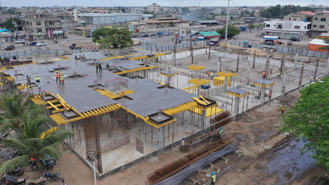
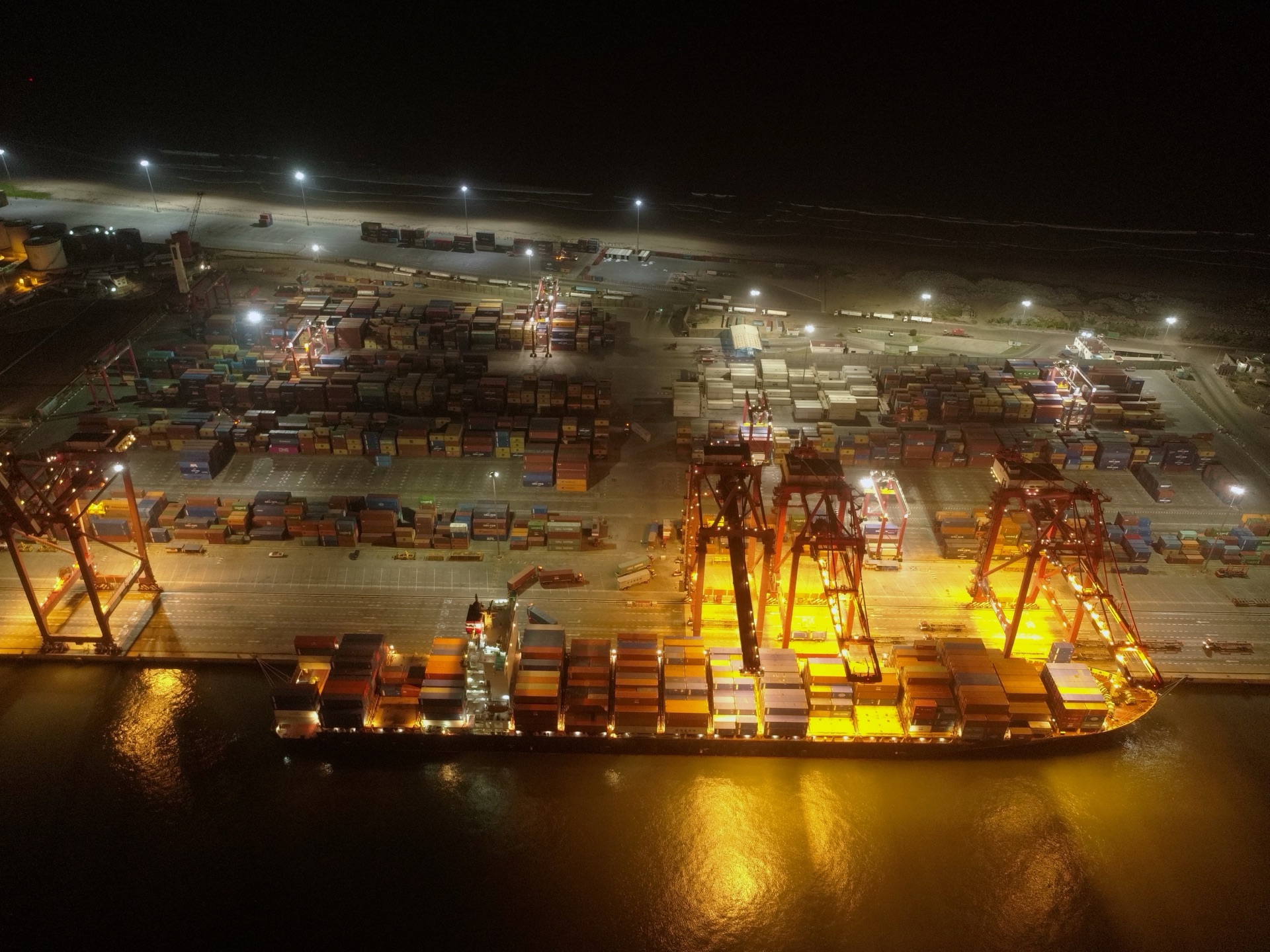
Site Monitoring
Periodic visual reporting, infrastructure inspection, and site surveillance
Mapping & 3D
Photogrammetry, orthomosaics and 3D modeling of terrains and structures
Visual Enhancement
Corporate films, commercials and cinematic multi-camera capture
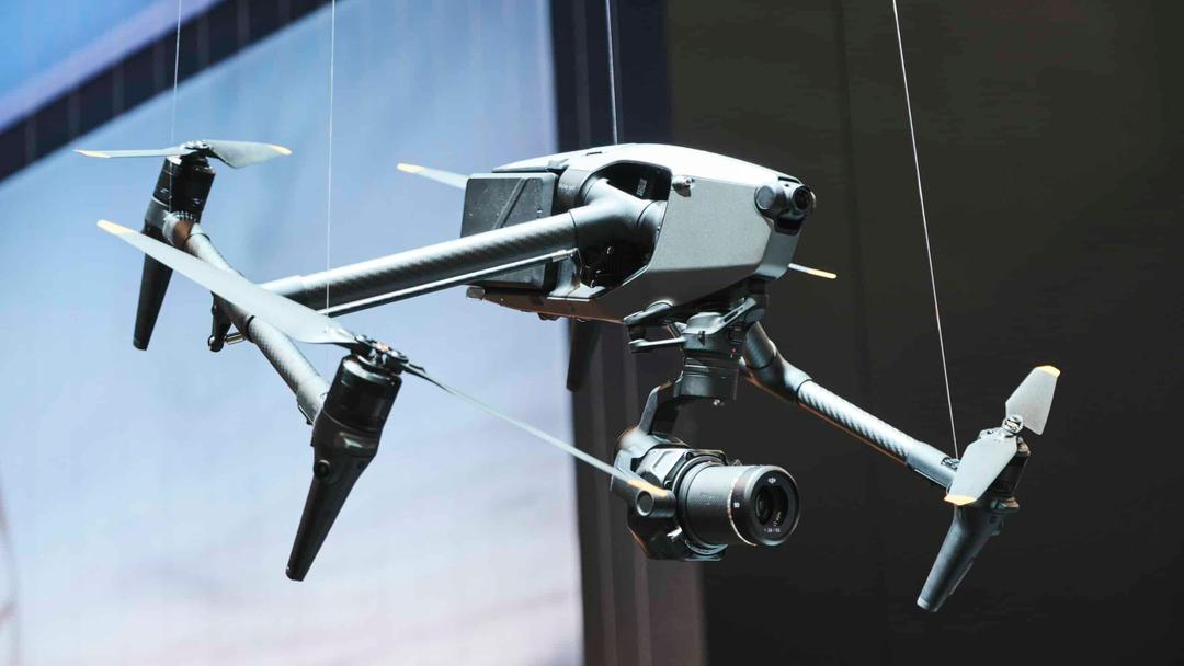
Drone Sales & Training
Supply of certified drones, pilot training and assistance with flight authorizations
Complete solutions
Site Monitoring & Inspection
Optimize the management and transparency of your projects with our aerial monitoring solutions. Our drones capture the progress of your construction sites with precision and regularity that traditional methods cannot achieve, giving your teams and clients total visibility on work progress
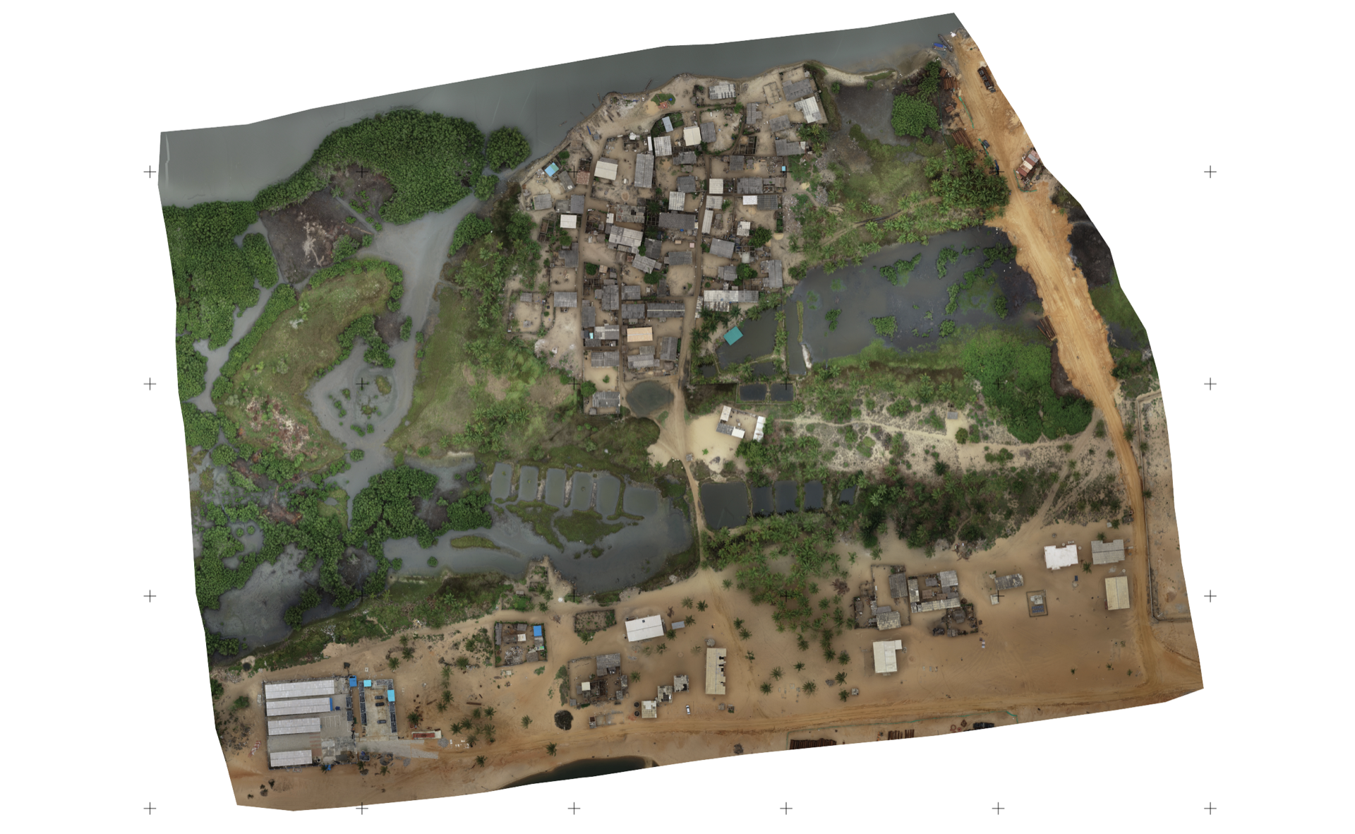
Precision Mapping & Modeling
Transform your construction sites into actionable data. Our photogrammetry equipment produces high-resolution orthomosaics, Digital Terrain Models (DTM), and 3D point clouds with centimeter-level accuracy. This data feeds directly into your BIM, CAD, and GIS software for seamless integration into existing workflows. Automated volume calculations let you track cut and fill volumes in real time
Visual Enhancement & Communication
Visual content is your best commercial and institutional asset. CINETAKA produces corporate films, ads, and event coverage showcasing your achievements to clients, partners, and funders. Our multi-camera capture mastery combined with cinematic aerial footage delivers professional results that set your projects apart and strengthen your market credibility
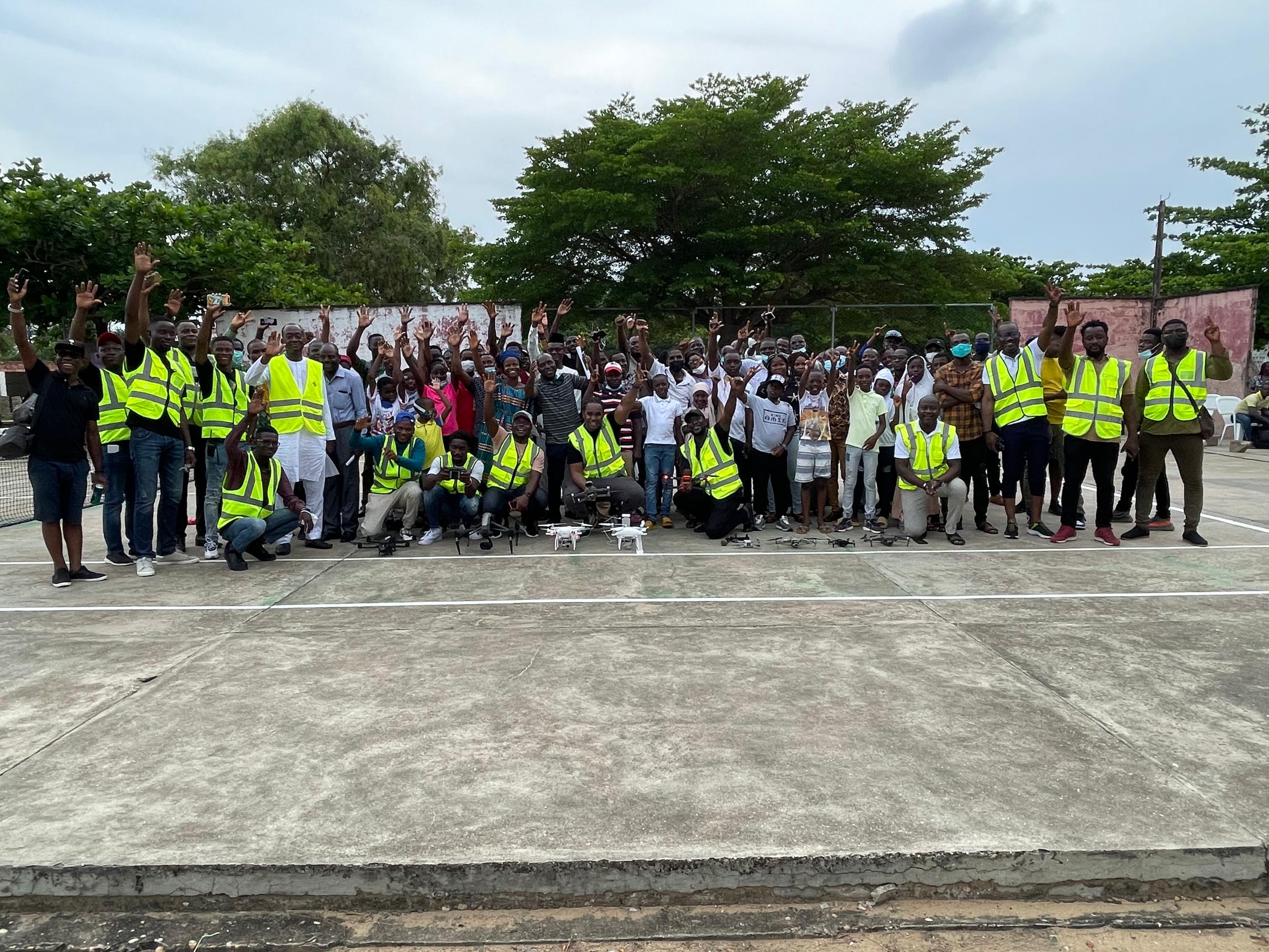
Drone Sales & Pilot Training
We support companies looking to internalize their drone operations. From selecting equipment suited to your specific needs, to comprehensive pilot training, to assistance in obtaining regulatory flight authorizations, CINETAKA accompanies you at every step. We provide certified professional drones and ensure long-term maintenance and technical support
Complementary Applications
Our drone solutions adapt to other strategic needs: precision agriculture with crop monitoring and water stress analysis, security and surveillance of sensitive sites, intrusion prevention and supervision of extended areas, as well as environmental and territorial management with ecological monitoring and observation of protected natural areas
A SOLID
FIELD EXPERIENCE
Years of field operations in Africa have allowed us to build an extensive network of media and technical experts, and to develop unique expertise adapted to the realities of the continent
+500 Projects
Drone solutions made for institutional and private clients
Hundreds of hours
Professional secure flights on various construction sites and infrastructures
Multi-country
Interventions in several African countries with mastery of local regulations
Expert Network
Extended network of media and technical specialists available for your projects
LET'S DISCUSS YOUR PROJECT
Whether you have a construction site to document, a project to showcase or a drone fleet to build, contact us for a consultation and discover how CINETAKA can transform your vision into usable images
Contact us